Whether used to map or describe a territory, to develop, exploit, or promote it, the map gradually emerged as one of the primary tools for the appropriation of aristocratic spaces in modern Europe. This cartography, widely utilized by historians of parks, gardens, forests, and estates, has however rarely been studied for its own sake [BOUDON, 1977; BOUDON 1991, ROSTAING, 2005; FRICHEAU, 2010]. This conference therefore aims to examine the methods of its production, uses, and dissemination, while exploring its role in the transformation of the environment and in the reconfiguration of an aristocracy that considered land ownership as a foundation of its social identity. Whether concerning parks, gardens, vegetable gardens, forests, or more broadly estates, the production of maps served both practical and identity function. Drawing inspiration from the sociology of space [LÖW, 2015] and adopting the approaches developed by the “spatial turn” in history [TORRE, 2008], our research stance considers aristocratic space as a social construction rather than an objective given, as a product of thought rather than a fact of nature. This space is therefore an artifact transformed by the increasingly widespread use of maps [VERDIER, 2015]. The primary aim of this conference is to examine simultaneously the history of cartography, the construction of space, the history of the aristocracy, and the history of its environment. It seeks to integrate all together the studies of parks and gardens [FRESSOZ, 2025; QUELLIER, 2012; SYNOWIECKI, 2021; DEVRED, 2022], forests and hunting [CORVOL, 2005; PINOTEAU, 2020], and state property management [VIVIER, 2009; LABOURDETTE, 2021] by approaching them from a cartographic perspective.
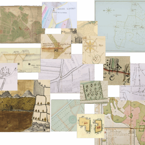
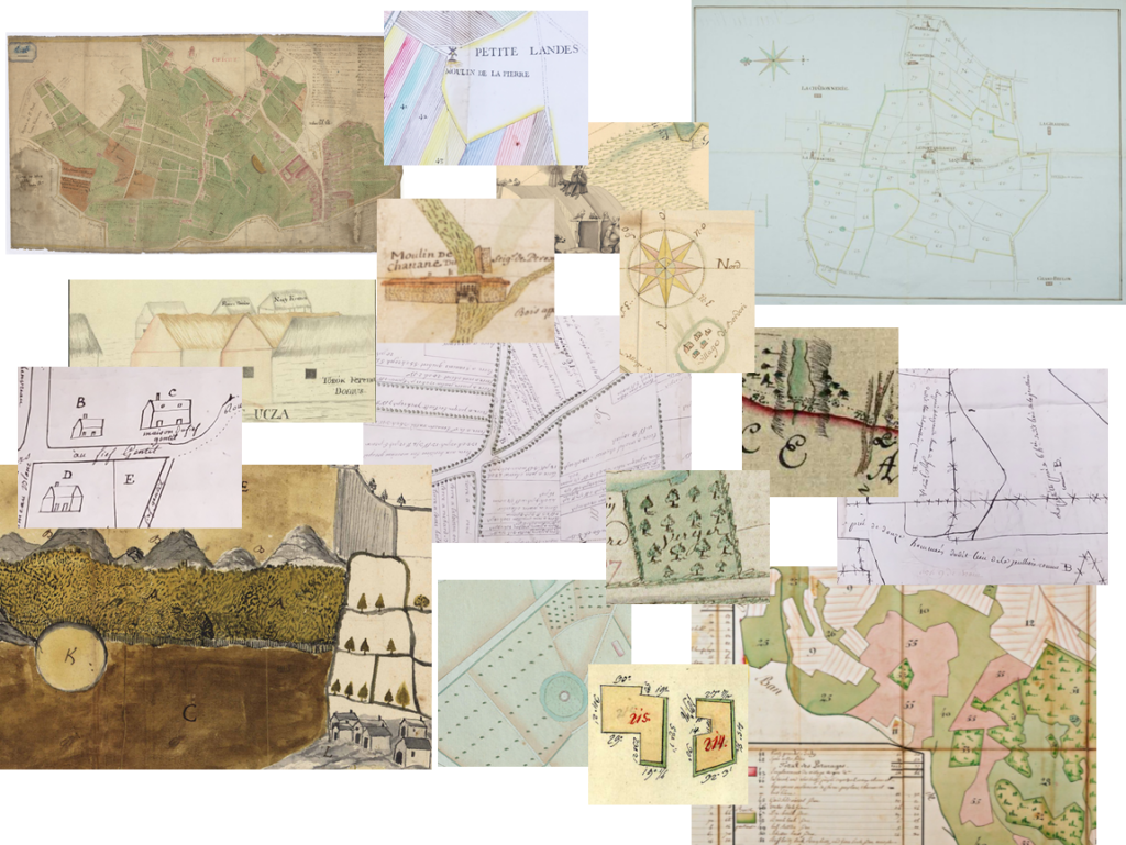
The corpus of documents is intentionally broad, so as not to limit the study to what is defined as a map today (i.e. a representation of a piece of land in a vertical projection). Indeed, from the 16th to the 19th century, “what is a map” took various forms (maps, plans, cross-sections, views, relief maps, etc.). The study of the choice of one or another of these media, their scales, and their evolution is part of the questions we wish to explore. With this broad conception of the corpus — ranging from drafts to printed versions, including “finalized” maps displayed on walls or reproduced in marquetry on various objects — the conference specifically aims to study the ways in which maps were disseminated, appropriated, and used by a wide range of actors (surveyors, gardeners, estate managers, landowners, rural communities, judicial and financial officials, ordinary guests…). This approach to cartographic literacies thus allows us to simultaneously examine the history of cartography, that of aristocratic practices, and that of its environment.
We propose to focus on three main questions of research.
- Why to map aristocratic spaces?
This first research focus aims to examine the uses of maps and their role in the aristocracy’s strategies for asserting its status. Whether for the purpose of representing, organizing, exploiting, or promoting their estates, or for managing conflicts arising within it, the production of maps and plans often contributed to the affirmation of a social status: that of the landowner. Contributions may address how social status was asserted through the act of cartography, in the selection of depicted areas, the design of ornaments and cartouches, or the physical characteristics of the map itself (material support, format, choice of colors, etc.), from the 16th to the 19th century.
In addition to questions of form, there are also the issues of the content and the discourse conveyed by maps. The creation of such a document is never trivial, given the rise in popularity of these representations during the cartographic turns of the 16th and 18th centuries. This first focus invites to examine the cartographic culture of the European aristocracy to understand how such a document gradually came to be established as a privileged medium for spatial discourse [VERDIER, 2015]. Reflections on the links between maps and memoirs, paintings, or even itineraries for visiting aristocratic gardens allow us to explore this phenomenon. The choice of techniques of representation also opens analyses on the representations and imaginaries conveyed by the illustration of aristocratic spaces. The mapping of hydraulic networks and fountains, the depiction of inhabited or abandoned residences, and the representation of topography according to different methods are all markers of spatial domination. The corpus may thus include depictions of castle or religious estates, linked to a discourse of territorial control by the nobility.
- Aristocratic spaces cartography as a practice
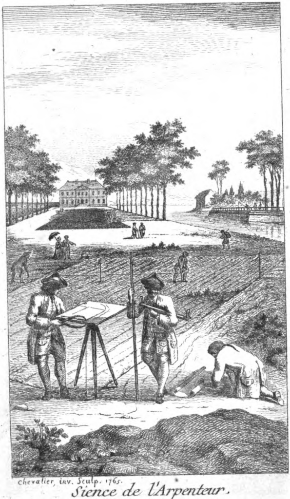
This second theme is devoted to a social history of cartographic techniques. After examining the backers who commissioned maps, we analyse their creators: who produced these maps, where, when, and how? One of the aims is to highlight the great diversity of producers (from surveyors to gardeners, including foresters, botanists, and even aristocrats themselves), while explaining how shared models and practices emerged through the exchange of gestures, perspectives, and techniques [GOUIRIC, 2004; JACOB, 2011; MILLET, 2016; BERT, 2023]. Reflecting on the circulation of actors and expertise is a way to avoid thinking each profession as a world closed in on itself [KORZUS, 2004; BINOIS, 2024].
This broader analysis should not obscure the specific characteristics of each type of map and each scale used. This second focus therefore encourages the development of a typological approach to maps that would not necessarily be based on distinctions between types of sites (gardens, parks, estates, etc.). One of the goals of this conference would be to consider the existence of other classification criteria, based on differences in the production or design of the maps, and to think about the question of their archival treatment.
- To territorialize with the map: a tool of environmental domination
This final focus aims to integrate into the study of aristocratic spaces the paradigms developed in environmental history [QUENET, 2015]. Cartography played a role in the domestication and control of the category of “nature” as redesigned by modern thinkers, as well as in asserting the idea of “resources” and their management [ARNOUX, 2023]. The papers will thus analyse the influence of this medium and its development on the transformation of the landscapes and ecosystems depicted. At the same time, the map should also be understood as a key tool enabling human actors to accommodate their projects with the environmental data that this type of production sought to capture [INGOLD, 2011].
This approach therefore encourages us to situate the aristocracy within the multitude of other actors — not only human but also non-human, or other-than-human [DESCOLA, 2005]. By engaging with the environments that aristocracy might seek to appropriate or domesticate (fauna, flora, rural societies…), the act of mapping did not serve only to spatialize the existing order for the purpose of contemplating, understanding, or studying it [BESSE 2015; COUEFFE, 2023]. It also aimed to make visible and perceptible a project expressed in relation to a territory to be dominated [ORTLIEB, 2025], despite shifting boundaries [CORVOL, 2004; DELCOURTE DEBARRE, 2017]. The map thus took on a function that became increasingly prominent during the modern era: to facilitate adaptations—or to orchestrate negotiations—between the various components of the environment [QUENET, 2019]. Maps produced in contexts of confrontation between rural societies and their lords, for instance, could be the subject of in-depth analysis to demonstrate how maps reflected (or failed to reflect) the issues of access to and control over the commons, their practices, and the conflicts that might arise from them. Similarly, maps may be able to shed light on the gendered uses of aristocratic spaces, a topic that has received little attention in the field of the history of cartography.
Organisation
The conference will take place from Thursday, October 22, to Saturday, October 24, 2026, at the Palace of Versailles. It is funded by the Palace of Versailles Research Center (CRCV). Proposals in French (though English is also accepted) must include a title, a 300-word abstract, your name and your institution of affiliation, as well as a brief bio-bibliography outlining your research interests. They must be submitted by June 1st, 2026, to the following address (colloque.cartesetdomaines@gmail.com) for evaluation by the scientific committee. Papers presented at the conference may be published in the CRCV Bulletin. Travel, accommodation, and meals will be covered by the CRCV within the limits of the budget allocated for this purpose.
Bibliography :
ANTOINE Annie et LANDAIS Benjamin (dir.), 2024, Cartographier le parcellaire rural dans l’Europe d’Ancien Régime, Rennes, PUR, 525 p.
BERT Jean-François, 2023, Le corps qui pense. Une anthropologie historique des pratiques savantes, Bâle, Schwabe & Co, série « Heuristiques », 171 p.
BESSE Jean-Marc et al., 2022, « Du jardin vers le monde et du monde au jardin », Cartes et Géomatique, n° 249, 106 p.
BESSE Jean-Marc, 2003, Face au monde, atlas, jardins, géoramas, Paris, Desclée de Brouwer, 244 p.
BESSE Jean-Marc, « cartographie et grandeurs de la Terre : aspects de la géographie européenne (XVIe-XVIIIe siècles) », in VAN DAMME Stéphane (dir.), Histoire des sciences et des savoirs 1, de la Renaissance aux Lumières, Paris, Seuil, 2015, p. 157-176.
BESSOT Didier, 2006, « Des perversions de la géométrie : Pratiques et théorisation des anamorphoses », in FARHAT Georges (dir.), André le Nôtre, fragments d’un paysage culturel, Sceaux, Musée de l’Île de France, p. 164-179.
BINOIS Grégoire et LAROQUE Claude, 2026, « La carte des chasses de Louis XV : genèse, production et héritage », Versalia, n°29, p. 123-142.
BINOIS Grégoire, 2024, Les Cartes en mains : le travail des topographes et la construction de la géographie militaire dans la France du XVIIIe siècle, thèse de l’université Paris et de l’université de Strasbourg, 2 tomes.
BOUCHENOT-DECHIN Patricia, 2014, « Le Nôtre à l’œuvre », In FARHAT Georges (dir.), André Le Nôtre en perspectives, Versailles, Château de Versailles, p. 144-163.
BOUDON Françoise, COUZY Hélène, 1977, « Le château et son site. L’histoire de l’architecture et la cartographie », Revue de l’Art, n°38, p. 7-22.
BOUDON Françoise, 1991, « Histoire des jardins et cartographie en France », in MOSSER Monique, Histoire des jardins, de la Renaissance à nos jours, Paris, Flammarion, p. 121 et suiv.
CHALVET Martine, Une histoire de la forêt, Paris, Le Seuil, 2011, 364 p.
CONAN Michel, 2002, Bourgeois and Aristocratic Cultural Encounters in Garden Art, 1550-1850, Washington DC, Dumbarton Oaks, 384 p.
CORVOL Andrée, « Droit de chasse et réserves à l’époque moderne », XVIIe siècle, n°226, 2005, p. 3-16
CORVOL-DESSERT Andrée, Les forêts d’Occident du Moyen-Âge à nos jours, Toulouse, Presses universitaires du Midi, 2004, 304 p.
COUEFFE Louise, 2023, Plantes, terrains et cultures botaniques : herboriser dans l’Ouest de la France au XIXe siècle, thèse de l’université d’Angers.
DELCOURTE DEBARRE Marie, « Reconstituer l’évolution des paysages forestiers La forêt de Mormal entre le XVIe et le XVIIIe siècle », Histoire & Mesure, vol. XXXII, 2017/2, p.39-65.
DESCOLA Philippe, 2005, Par-delà nature et culture, Paris, Gallimard, 623 p.
DEVRED Raphaël, 2024, Le Domaine de Rambouillet, une histoire environnementale du pouvoir, de la chasse et de l’élevage (1783-2010), thèse de l’université Paris Saclay, 1064 p.
FRESSOZ Jean-Baptiste et al., 2025, La nature en révolution. Une histoire environnementale de la France, 1780-1870 (vol.1), Paris, La Découverte.
FRICHEAU Catherine, 2010, « Jardins dessinés et dessins de jardins. Le cas du XVIIe siècle français », Projets de paysage. Représentations, perceptions, pratiques et constructions paysagères, n°4. https://doi.org/10.4000/paysage.23207
GOUIRIC Nicole, 2004, « Remarques sur l’interprétation des cadastres de Méréville », Polia – Revue de l’art des jardins, n°2, p. 41-62.
INGOLD Alice, 2011, « Écrire la nature. De l’histoire sociale à la question environnementale ? », Annales, n°66-1, p.11-29
JACOB Christian (dir.), 2011, Lieux de savoir. vol. 2 : Les mains de l’intellect, Paris, A. Michel, 985 p.
KORZUS Bernard, 2004, « Georges-Louis Le Rouge : un cartographe franco-Allemand du XVIIIe siècle », in ROYET Véronique (dir.), Georges-Louis Le Rouge, les jardins anglo-chinois, BNF, p. 45-55.
KOYOUMJIAN Phillip, 2021, « Ownership and use of maps in England, 1660-1760 », Imago Mundi, vol.73, n°1, p. 32-45.
LABOULAIS Isabelle (dir.), 2008, Les usages des cartes (XVIIe-XIXe siècle), Strasbourg, PUS, 285 p.
LABOURDETTE Jean-François, 2021, La Maison de la Trémoille au XVIIIe siècle, Paris, Honoré Champion, 518 p.
LÖW Martina, 2015, Sociologie de l’espace, Paris, MSH, 302 p.
QUELLIER Florent, 2023, « L’âge d’or du potager aristocratique », in Histoire du jardin potager, Paris, Armand Colin, p. 84-113
QUENET Grégory, 2015, Versailles, une histoire naturelle, Paris, La Découverte, 224 p.
MILLET Audrey, 2016, « Tracer le monde : outils et instruments de la Renaissance aux Lumières », Artefact. Techniques, histoire et sciences humaines, vol.4, p.215-231.
MORILLON Marie, 2022, « L’apport de l’étude d’un corpus de cartes anciennes dans la connaissance des jardins : l’exemple du château de Maisons », Les Cahiers de l’École du Louvre, n°18.
ORTLIEB Jean-Baptiste, 2025, La Fabrique des sommets : une histoire environnementale des sommets des Vosges méridionales (XIIIe-XVIIIe siècle), thèse des universités de Strasbourg et d’Anvers.
PINOTEAU Henri, 2020, Les Chasses de Louis XVI : splendeur et ruine des plaisirs de Sa Majesté (1774-1799), Rennes, PUR, 286 p.
ROSTAING Aurélia, 2005, André Le Nôtre dessinateur de jardins et les jardins français du XVIIe siècle, thèse de l’EPHE, 3 vol.
ROSTAING Aurélia, 2006, « La bêche ou le compas ? Le métier de jardinier dans la première moitié- du XVIIe siècle », in FARHAT Georges (dir.), André le Nôtre, fragments d’un paysage culturel, Sceaux, Musée de l’île de France, p. 74-87.
STRONG Roy, 2000, The Artist and the Garden, New Haven, Yale University Press, 288 p.
SYNOWIECKI Jan, 2021, Paris en ses jardins : Nature et culture urbaine au XVIIIe siècle, Ceyzérieu, Champ Vallon, 433 p.
TORRE Angelo, 2008, « Un “tournant spatial” en histoire ? Paysages, regards, ressources », Annales, n°63-5, p. 1127-1144
VAN DAMME Stéphane, Seconde Nature. Rematérialiser les sciences de Bacon à Tocqueville, Les presses du Réel, 2020, 271 p.
VERDIER Nicolas, 2015, La Carte avant les cartographes, l’avènement du régime cartographie en France au XVIIIe siècle, Paris, Publications de la Sorbonne, 377 pages
VERIN Hélène, 1991, « La technologie et le parc : ingénieurs et jardiniers en France au XVIIe siècle », in MOSSER Monique, Histoire des jardins de la Renaissance à nos jours, Paris, Flammarion, p. 131-142.
VIVIER Nadine (dir.), 2009, Élites et progrès agricoles, XVIe-XXe siècle, Rennes, PUR, 346 p.
